
Drone Photography - Staunton, VA
Drone Photography
in Staunton, VA.
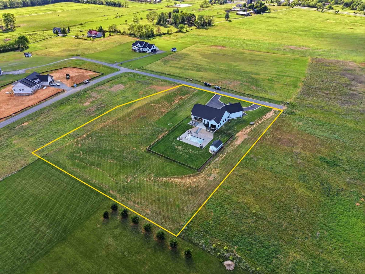
FAA Part 107 certified aerials showing lot lines, pasture, the approach, and the Blue Ridge on the horizon. Based 10 minutes east in Waynesboro, with no travel fee anywhere in Staunton.
Why it matters here
Augusta County is
bigger than a wide lens.
A lot of the inventory around Staunton is not a house on a quarter-acre lot. It is a house on eleven acres with a barn, a creek, a fence line, and a view, and none of that survives in a photo taken from the driveway. Ground-level photography can only ever answer what the house looks like. The questions that actually decide whether a buyer drives out here are all questions about the land: where does the property end, how does the drive come in, what is behind the tree line, and is the mountain view from the porch or from the far corner of the field.
An aerial answers every one of them in one frame. On land and acreage listings it is frequently the only photograph that does any real work, and on in-town listings it still does something useful by showing the block, the walkability to downtown, and how the lot actually sits.
Every flight is by an FAA Part 107 certified pilot, flown legally and insured. Staunton sits inside Shenandoah Valley Regional Airport's airspace, so most flights here need LAANC authorization. I obtain it myself, before the shoot, at no extra charge to you.
Where aerials earn their cost
Four Staunton listings
that need to be flown.
Farms and acreage toward Churchville, Middlebrook, and Swoope
Past a few acres, the listing stops being about the house. A buyer wants to know how much is cleared, how much is wooded, where the outbuildings sit relative to the residence, and whether the fencing is usable. One aerial does more for that conversation than twenty ground photos, and a boundary overlay drawn from the plat turns it into something a buyer can actually evaluate before they spend a Saturday.
Land and lot listings with no house on them
A vacant parcel is close to unphotographable from the ground, because every field looks like every other field. From the air it becomes a specific piece of land with specific road frontage, a specific tree line, and a specific relationship to the ridge, which is exactly what a builder or a custom-home buyer is trying to work out.
Historic downtown listings where the block is the selling point
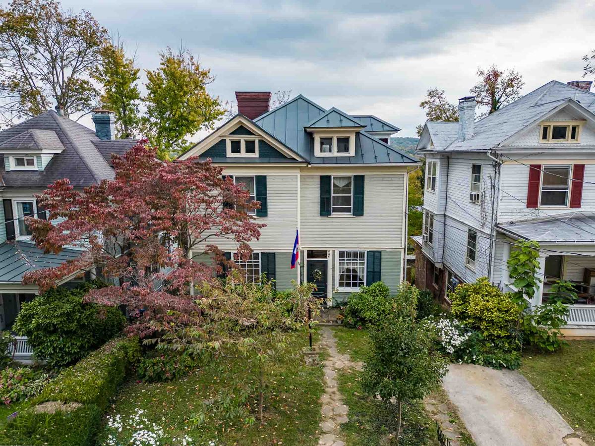
On Gospel Hill, in Newtown, and around the Beverley district, part of what someone is buying is the street: the rooftops, the proximity to downtown, and the fact that they can walk to the Blackfriars Playhouse. A low aerial shows the house in its actual context in a way a straight-on facade shot never can, and it makes the neighborhood part of the pitch instead of a line in the remarks.
Commercial property near the I-81 and I-64 interchange
For commercial and investment inventory the pitch is almost always access and visibility, and both are aerial arguments. A single frame can carry the interchange, the road frontage, the parking count, and the neighboring tenants, which replaces a paragraph of narrative with a photograph.
Staunton, VA
Pricing and turnaround.
Aerials are $95 as an add-on to a photo shoot, or $150 standalone if you only need the flight. Drone video runs from $125 for an aerial clip and $165 for a walkthrough plus aerial. 24-hour delivery is standard, files come MLS-sized and ready to upload, and every service is eligible for Pay at Close at $0 upfront.
No travel fee in Staunton, Fishersville, Verona, Stuarts Draft, or Greenville. Adding aerials to a shoot you have already booked costs about fifteen extra minutes on site.
Common questions
Staunton drone work, answered.
Yes. All Villa Views drone work is flown by an FAA Part 107 certified remote pilot and insured. Staunton falls inside Shenandoah Valley Regional Airport's airspace, so most flights here require LAANC authorization, which I obtain myself before the shoot at no extra charge to you. In the rare case an address genuinely cannot be flown, I tell you before you book rather than after, so it never becomes a surprise on listing day.
$95 when added to a photo shoot, or $150 as a standalone flight. Drone video is $125 for an aerial clip or $165 for a walkthrough plus aerial. There is no travel fee anywhere in Staunton, Fishersville, Verona, Stuarts Draft, or Greenville, and Pay at Close is available on all of it at $0 upfront.
Yes, and on Augusta County land listings it is one of the most useful things you can publish, because it answers the first question every buyer has about a parcel. Boundary overlays are drawn onto the aerial from the plat or county GIS data, which makes them a marketing illustration rather than a survey, and the listing should say so.
Aerials need reasonable wind and a usable sky. If conditions will produce flat, grey, unconvincing aerials, I will say so and fly on a better day rather than hand you something you would not want to publish. The ground photography still happens on schedule, so your listing timeline never waits on the drone.
Enough to cover the property properly rather than a fixed count padded out with near-duplicates. In practice that means the establishing frame showing the house in its setting, the parcel and its boundaries, the approach, and whatever the property is actually selling. Acreage and land listings take more frames, and that is included rather than upcharged.
Within 24 hours, the same as the rest of the shoot, with same-day available at checkout. Files arrive edited and MLS-sized, so a Tuesday afternoon flight is on the MLS Wednesday morning.